Commitment to accuracy, regular updates, and detailed cartography are the foundational values of Explorer Chartbooks Bahamas charts. Celebrating the 30thanniversary of publication this year, the team at Lewis Offshore, Ltd. has focused its efforts on offering the most comprehensive charts and cruising information for The Bahamas.
The latest editions of Explorer Chartbooks have been updated using observations from on-the-water surveys conducted by the Lewis Offshore team, as well as contributions from transiting vessels.
Explorer Chartbooks has forged a relationship with Aqua Map mobile navigation app and Waterway Guide Media to offer the same charts and cartography in both publications and the app.
You can now seamlessly and intuitively cross-reference and plan navigation with the Waterway Guide Bahamas guidebook, the applicable Explorer Chartbooks edition, and Aqua Map's downloadable Bahamas charts.
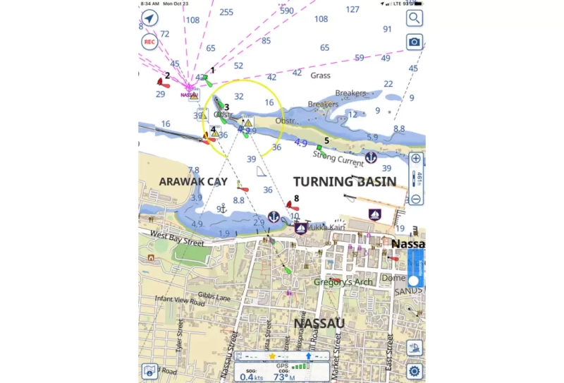
Depths, contours, locations, and symbology are uniform across all the platforms and publications, which means that when planning your expedition to the Bahamas, you have a consistent and complementary suite of books, charts, and a mobile navigation interface all designed for an optimal user experience.
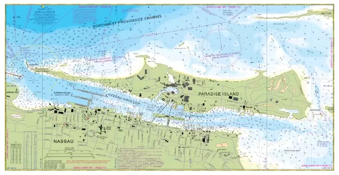
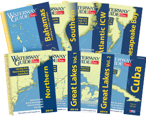
Explorer Chartbooks charts offer details and varied scales in their 12" x 18" water resistant format spiral bound books with the latest updates, advice for where to provision, destinations, and more. Cruising, charting, and exploring The Bahamas since 1974 and charting since 1991, the team at Lewis Offshore, Ltd. publishes the leading three-volume set of chartbooks for the Near Bahamas, Exumas and Ragged Islands, and the Far Bahamas with Turks and Caicos. Electronic data from the Explorer Chartbooks is also available through numerous chart plotter and mobile app providers.
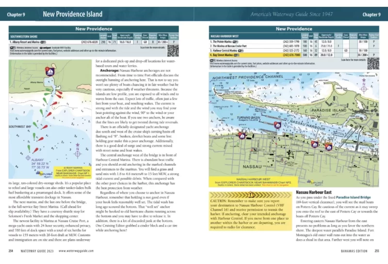
Waterway Guide's Bahamas edition contains over 90 chart extracts from Explorer Chartbooks that provide situational awareness and citations for where to locate the complete charts by edition and page numbers.

Aqua Map's mobile app interface displays the Explorer Chartbooks cartography in the same color scheme as the printed charts and maintains the complete downloadable Bahamas chart library in its repository of in-app purchases. Available in both raster and vector formats, the charts in Aqua Map are the same as in the Explorer Chartbooks and Waterway Guide's books. The charts are scalable, searchable, and contain additional data overlays for informed planning and navigation, including Waterway Guide marinas, anchorages, bridges, and fuel locations.
Waterway Guide Bahamas, Explorer Chartbooks by Lewis Offshore, Ltd., and Aqua Mapare updated real-time, daily, and biennially depending on how the information is being displayed. The publishers have combined their expertise and commitment to accuracy to offer the most reliable and accurate data for your next adventure to The Bahamas. Look for special pricing when purchasing bundles.
Important Links:
The New Standard for Bahamas Charts, Navigation Advice and Apps
Explorer Chartbooks: 40 Years of Excellence


- 4,000 Marinas
- Thousands of anchorages
- Updated Charts
- Mile-by-Mile Navigation
- Highlighted Alerts & Cautions
- Full-Color Aerial Photographs
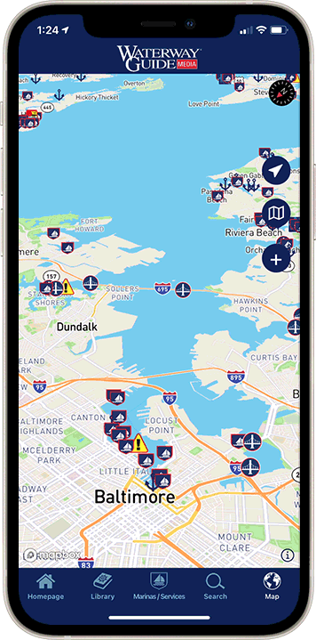
The Waterway Guide App Makes it easy to leave reviews, use our explorer, and view waterway guide materials all on the go!