The Erie Canal is a major component of the New York State Canal System. The 524-mile inland water route ascends 571 feet from Waterford to Buffalo. It connects 16 counties; over 200 cities, towns and villages; two Great Lakes; numerous inland lakes; and New York City, Canada and the rest of the world.

Historical Background
Sometimes sarcastically referred to as Clinton's Ditch or Clinton's Folly after its main proponent, New York City Governor Dewitt Clinton, the original Erie Canal was indeed a ditch at only 4 feet deep and 40 feet wide. The hand-dug waterway crossed western New York through forests and swamps and over rivers and a mountain range with 83 locks and 18 aqueducts. The canal climbed from sea level on the Hudson River at Albany to Lake Erie's 571-foot elevation at Buffalo. This humble ditch, completed in 1825, opened a water route from the Atlantic Ocean to the Great Lakes and the Midwest.
The Erie Canal has operated continuously every navigation season since 1825. It was enlarged twice and in the 1910s modernized and mechanized, creating the NY State Barge Canal. The route changed, mostly in the central and eastern sections, using lakes and constructing dams to canalize rivers. The monumental stone arched aqueducts that carried the canal over rivers and were abandoned and, in many cases, destroyed.
The New York State Barge Canal was renamed the New York State Canal System in 1992. In 2000 the U.S. Congress designated this historic waterway as the Erie Canalway National Heritage Corridor. Today, the New York State Canal System is managed by the New York Canal System and recognized as a National Historic Landmark.
If you're a history buff, the New York Canal System is a time machine. If you're a futurist, it's a study of unbridled optimism. And if you're a boater, it's one of the best cruises you will ever take. Enjoy the trip!
NOTE: This year marks the 200th consecutive season of navigation along the New York Canals. The 200th anniversary of the original completion of the canal and opening will be commemorated as the Erie Canal's bicentennial in 2025.
Charts & Information
If you are planning a trip to this area, make certain you have the proper charts– paper, electronic, or both. When reviewing the charts, you will find that only part of the Erie Canal has been charted; no charts exist for the western portion from Lyons to Tonawanda, NY.
If your travel plans include the western half of the Erie Canal, mapping produced by the Canal Corporation may be downloaded online from New York State Canals. Take some time and explore the site, which contains a wealth of information (including water depths, bridge clearances, and navigation notices) that will make your journey on the waterway much more pleasant.
Before starting your trip be sure to refer to Canal Notices and Alerts for up-to-the-minute information on water levels, closures or restrictions on docking due to events.
We also recommend you keep Cruising The New York Canal System, a Skipper Bob publication on hand.
Regulations & Recommendations
Because of its excellent buoy system, cruising the New York State Canal System is normally a matter of carefully following the charts and always keeping a lookout for "canalligators," the occasional log or piece of floating debris. Report large logs or "deadheads" to the lock operator. Canal cruisers traveling in early spring may encounter higher water, swifter currents and more debris during melt-off than those who travel later. Boats with unprotected propellers should stay particularly alert.
According to the New York Canal Corporation's website, "Canal Speed Limits are established to regulate the speeds of vessels transiting through the New York State Canal System in a way that minimizes wake damage to residential property and canal infrastructure, while ensuring that recreational and commercial boaters have a safe and enjoyable experience on the waterway. Locks along the canal system are set up to admit traffic through based on travel times in accordance with established limits, so exceeding the speed limit when traveling from lock to lock will not result in traveling through the canal system more quickly."
Check for speed limit signs as you exit a lock or double check with a lock operator. Speed limits are enforced. Exceeding the speed limit can result in delays at the locks, fines or revoking your permit. The New York Canal Corporation has a map showing speed limits along the canal, among other helpful information.

New York Canal Corporation advises wake characteristics for each speed zone must not exceed the following:
- 5 mph (red zone)–Flat water with not even a ripple trailing the vessel.
- 10 mph (yellow zone)–A ripple but no wake behind the vessel. (A ripple is defined here as a small non-whitecap wave that is not large enough to rock a floating dock or less than about 12-inch in amplitude.)
- 30 mph and above (green zone)–For vessels capable of getting up on plane this is allowed in river and lake sections. Wakes produced when up on plane is acceptable if not near a dock or other vessels.
Controlling Factors
The controlling depth of the Erie Canal from Waterford to Oswego is nominally 11 feet deep. The western Erie Canal has a controlling depth of 9 feet. Controlling depth on the Cayuga-Seneca Canal is 8 feet deep. These are nominal guides only. Always be aware of areas where shoaling can occur.
Note: Bridge height restrictions are 21 feet from Waterford to Three Rivers Junction through Oswego and 15.6 feet from Three Rivers Junction to Tonawanda.
Sailboats will need to un-step their masts. Depending on your approach to the canal and the direction in which you are traveling, there are DIY or marina-operated cranes from which to choose. On the Hudson River you can stop at Hop-O-Nose Marina (518-943-4640) on the Catskill River about 41 miles south of Troy. Or you can stop at the Castleton Boat Club (518-732-7077), 16.6 miles south of Troy and DIY by paying a fee to use their crane. There are other marinas farther south on the Hudson River that are able to do mast work but that means more time in the sometimes choppy Hudson River waters with a mast strapped across your boat.
At the west end of the Erie Canal in North Tonawanda, NY, you can use the services of the Wardell Boat Yard (716-692-9428) located on the north side of the canal just before the first fixed bridge when east bound on the canal or Smith Boys Marine Sales (716-695-3472) on the northern side of Tonawanda Island. Other options, slightly farther away on the Niagara River include Rich Marine Sales (716-873-4060) or RCR Yachts Buffalo (716-856-6314). (Service is only available at RCR Yachts between mid-June and mid-September.)
Many Canadians opt to have their mast work done in Port Colborne, ON due to the limited availability in New York. Sugarloaf Harbour Marina (905-835-6644), run by the City of Port Colborne, offers full-service mast stepping (by reservation). The only downside to this option is you have to travel nearly 20 miles in open water with a mast strapped to your boat before reaching Buffalo. On the Oswego Canal southbound, mast stepping is done at Oswego Marina (315-342-0436), just north of the entrance to the Oswego Canal on the east side. Reservation is required at all times.

Each of these marinas will step (or un-step) your mast for a fee. It is best to call ahead and make reservations. If un-stepping your mast, the lumber for mast cradles to support the mast on your deck can usually be found at these marinas in the form of used cradles from boats that previously stepped their masts there but there may be an extra fee.
In the case of unusually tall masts (60 feet or longer), be sure and check ahead to see if the marina can handle a mast that size. In some cases, exceptionally large masts will have to be stepped or un-stepped at a shipyard some distance from the canals.
Some boat yards can arrange to have the mast shipped to a final destination if you choose not to carry it onboard. If your vessel approaches the air or water draft limits, get up-to-the-minute information at New York Canal System or call 800-4CANAL-4 or 800-422-6254.
VHF Channels
Lock and bridgetenders monitor VHF Channel 13. Call ahead to announce your arrival on VHF or cell phone. (Phone numbers can be found at New York Canal System.) Most locktenders carry a handheld VHF, so their range is limited. The signal on the New York Canal System is three blasts to request to lock through.
Be patient...The locktender may be busy helping another boat coming in the opposite direction or doing maintenance work around the lock. Locktenders will ask you how far you intend to go for the day and generally call ahead so the next lock or bridge anticipates your arrival.
Schedule & Fees
Mariners are advised that, conditions permitting, all portions of the New York State Canal system opened Friday, May 17, 2024, at 7:00 a.m. for the 2024 navigation season. Tolls and fees for recreational vessels on the New York State Canal System have been waived through 2024.
Locks and lift bridges generally operate daily from 7:00 a.m. to 5:00 p.m. but some locks and bridges operate until 10:00 p.m. during peak season. Navigation alerts and operational hours are posted at New York Canal System–Hours of Operation or call 1-800-4CANAL4.
Note that hours of operation or closures may change at any time due to a break in the canal wall, an accident, extreme high or low water, or debris. If this happens, the Guard Gate will be shut to isolate sections of the canal for maintenance. When inadvertent closings happen, canal operators are extremely helpful to stranded boaters. Fortunately, closures are not the norm and you can expect to travel the entire length of the canal without interruption. If you do encounter a delay, it will be with your safety in mind.
For more information on Locking Through, see our previous article here.
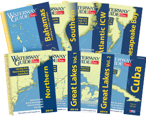
For additional information on navigating the New York State Canal System, see Chapter 2 of Waterway Guide's Great Lakes Volume 1.


- 4,000 Marinas
- Thousands of anchorages
- Updated Charts
- Mile-by-Mile Navigation
- Highlighted Alerts & Cautions
- Full-Color Aerial Photographs
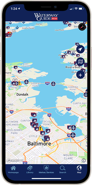
The Waterway Guide App Makes it easy to leave reviews, use our explorer, and view waterway guide materials all on the go!